In today’s aviation landscape, relying solely on static charts is no longer sufficient. With constantly evolving airspace restrictions, shifting geopolitical conditions, and complex aviation permit requirements across Middle and Southern Africa, flight planning demands real-time visibility and precision.
Traditional charts and text-based NOTAMs often fail to provide the clarity operators need. Critical updates can be buried in lengthy documents, increasing the risk of oversight. For operators managing multi-country routes, this creates inefficiencies, delays, and potential compliance issues.
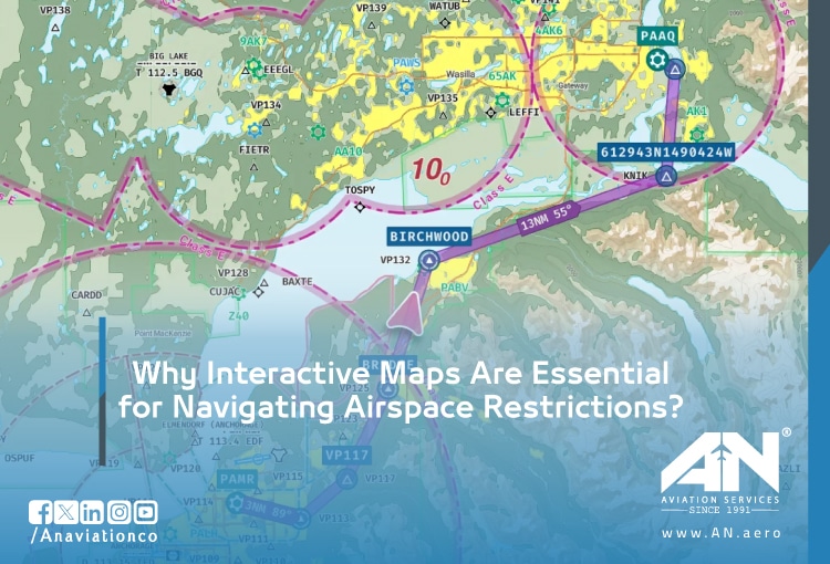
Modern flight planning requires smarter tools. Interactive, data-driven platforms now allow operators to visualize restrictions, understand permit requirements, and optimize routes with confidence.
What an Interactive Airspace Map Should Show?
An interactive airspace map gives a real-time, visual view of airspace restrictions and permit requirements, helping operators make faster, more accurate flight planning decisions.
Dynamic Overlay Layers
A powerful interactive airspace map goes far beyond static visualization. It provides layered, real-time insights that transform how operators interpret complex environments.
Key features include:
- Geographically displayed NOTAMs: Current NOTAMs appear directly on the map, eliminating the need to scan long text lists.
- Active military zones with time windows: Clearly marked restricted areas with activation schedules to avoid unexpected conflicts.
- Conflict zones and no-fly areas: Instant visibility into high-risk regions and restricted airspace.
- Volcanic ash cloud forecasts: Predictive dispersion models to support safer routing decisions.
- FIR (Flight Information Region) boundaries: Clear identification of controlling authorities across regions.
Permit Requirement Indicators
Understanding aviation permit requirements becomes significantly easier with visual cues embedded into the map.
- Countries requiring overflight permits vs. exemptions
- Landing permit requirements for technical stops
- Lead time alerts (e.g., “5+ days required”)
- Mandatory local agent requirements
This removes guesswork and allows operators to act proactively.
Route Planning Integration
Interactive maps should not only display data, but they should also enable decisions.
- Plot routes and instantly identify airspace restrictions
- Estimate additional distance and fuel when rerouting
- View suggested alternative corridors
- Evaluate routes based on permit feasibility
This integration turns planning into a dynamic, efficient process.
Pinpoint Problems & Your Action Plan
For Flight Planners
Problem:
You’re planning a Europe–Southern Africa cargo flight. NOTAMs are reviewed, but a temporary restriction over Niger is buried deep in the text.
Action:
Use a visual NOTAM tool. AN Aviation Services provides interactive maps where restrictions appear as clear, color-coded zones so you see critical updates instantly, not after scanning dozens of pages.
For Private Operators
Problem:
A client requests a last-minute reroute to avoid high permit costs, but alternative corridors are unclear.
Action:
Leverage real-time mapping tools. Our platform highlights open airspace, restricted zones, and required permits, allowing you to select compliant, cost-efficient routes instantly.
For Dispatchers
Problem:
A sudden airspace closure forces immediate rerouting across multiple flights.
Action:
Use a map with alerting capabilities. AN Aviation Services monitors NOTAMs and geopolitical developments 24/7, assessing impact and delivering rerouting solutions with updated permit requirements in real time.
For Charter Brokers
Problem:
Quoting a flight across 10+ countries requires manual verification of each country’s requirements.
Action:
Use a route analyzer. Plot the journey and instantly receive a breakdown of permits, lead times, and restrictions. AN Aviation Services provides accurate, route-specific analysis to reduce errors and speed up quoting.
Mapping the Permit Landscape: Middle & Southern Africa by Sub-Region
West Africa (Gateway to the South)
In West Africa, countries such as Nigeria, Ghana, Senegal, and Ivory Coast offer relatively structured systems but still require careful planning. Nigeria mandates permits for foreign aircraft transiting its airspace, while Ghana applies per-leg charges. An effective interactive map should clearly indicate which airports require mandatory ground handling for technical stops, helping operators plan efficiently.
Central Africa (The Bottleneck)
Central Africa presents a more complex operating environment, often acting as a bottleneck for flight planning. Countries including Cameroon, the DRC, Congo, and Chad may require permit lead times exceeding one week. Additional restrictions can apply depending on aircraft type, and coordination between civil and military authorities often causes delays. Interactive maps are essential here, highlighting high-risk corridors and suggesting alternative coastal routes.
East Africa (The Digital Frontier)
East Africa is rapidly advancing through digitalization. Kenya, Tanzania, Uganda, and Ethiopia are leading this shift, with Kenya’s AATIS portal enabling permit processing within approximately 48 hours. However, variations remain for example, Tanzania requires separate permissions for Zanzibar flights. Interactive maps should distinguish between digital and manual permit systems to streamline planning.
Southern Africa (The Efficient Hub)
Southern Africa stands out as one of the most efficient regions for aviation operations. Countries such as South Africa, Angola, Mozambique, Zambia, and Zimbabwe generally offer faster processing times. South Africa averages around 72 hours, while Angola and Mozambique typically require two to three days. In this region, interactive tools should display navigation fee requirements and highlight preferred entry points to support compliant and cost-effective routing.
How AN Aviation Services Uses Interactive Mapping for Clients?
Custom Route Analysis
AN Aviation Services provides tailored route planning support using advanced interactive mapping tools. Clients receive:
- Optimized routing based on current airspace restrictions
- Full visibility of permit requirements across all jurisdictions
- Fuel and distance impact assessments
Real-Time Alerts for Active Routes
Flight environments can change rapidly. AN Aviation Services ensures clients stay ahead with:
- 24/7 NOTAM and geopolitical monitoring
- Instant alerts for airspace closures or disruptions
- Immediate rerouting recommendations with updated permits
From Static Planning to Smart Navigation
In regions as complex as Middle and Southern Africa, static charts are no longer enough. Operators need clarity, speed, and accuracy to navigate evolving airspace restrictions and meet aviation permit requirements without delays.
Interactive maps transform flight planning from a reactive process into a proactive strategy, reducing risk, saving time, and improving operational efficiency.
With AN Aviation Services, operators gain access to intelligent tools and expert support that make even the most complex routes manageable.