In aviation, wind is not just another environmental factor; it directly affects runway selection, aircraft performance, fuel planning, and overall flight safety. A slight miscalculation in wind direction or speed can significantly impact landing distance, crosswind limits, and approach stability.
For decades, the aviation industry has relied on two primary tools to understand wind conditions: the traditional aviation windsock and modern aviation weather sensors. While both are designed to provide wind information, they represent two very different philosophies, one based on simplicity and visual interpretation, and the other on precision and digital integration.
In regions like Egypt and across Africa, where operating environments can vary widely from fully equipped international airports to remote airstrips, the importance of having both systems becomes even more critical.
Two Ways to Read the Wind, One Critical Goal
At their core, both windsocks and weather sensors exist to answer the same operational question: what is the wind doing at this exact moment?
A windsock provides immediate visual feedback. It allows anyone on the ground or in the air to quickly assess wind direction and estimate its strength without relying on any external system. This makes it especially valuable in time-sensitive situations such as final approach or ground maneuvering.
Weather sensors, on the other hand, transform wind into precise numerical data. They continuously measure and transmit wind speed, direction, and variability to multiple systems simultaneously, including air traffic control, cockpit displays, and flight planning platforms.
The key difference lies in how the information is delivered and used. One supports human judgment directly, while the other feeds automated and data-driven decision-making processes.
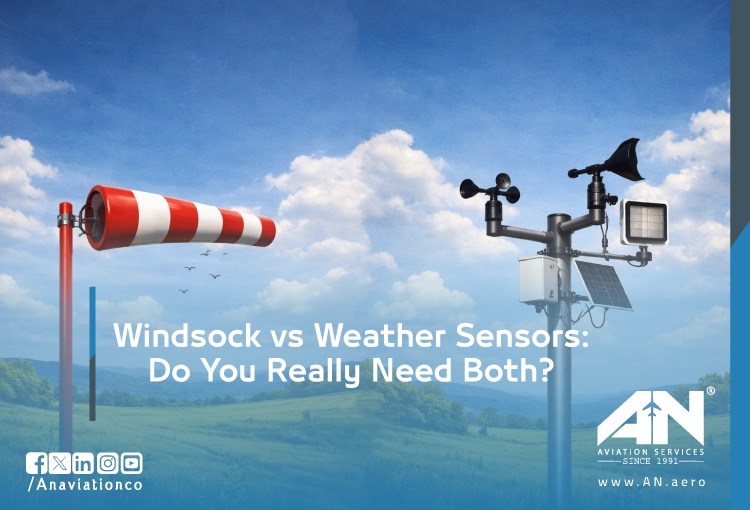
The Windsock: The Original Wind Indicator
How It Really Works in Practice?
A windsock is designed with specific proportions and materials to react predictably to wind. As air flows through the fabric tube, it inflates and aligns itself with the wind direction. The angle of extension gives a rough indication of wind speed.
Pilots are trained to interpret these visual cues instinctively. A fully extended windsock indicates stronger winds, while a partially raised or limp windsock suggests lighter or calmer conditions. This interpretation happens in seconds and requires no instrumentation.
Why Windsocks Still Matter in Egypt and Africa?
In many parts of Egypt and Africa, operational conditions are not always ideal. Power interruptions, limited infrastructure, and remote landing sites are realities that aviation professionals must plan for.
In such environments, the windsock becomes more than just a supplementary tool. It serves as a reliable, always-available source of wind information that does not depend on electricity, connectivity, or system health.
Even at well-equipped airports, contingency planning assumes that electronic systems may fail. In those moments, the windsock becomes the primary reference for pilots, especially during landing and takeoff.
Human Interpretation and Situational Awareness
One of the most overlooked advantages of a windsock is its ability to enhance situational awareness. Unlike digital readings, which present a single value, a windsock shows behavior over time.
Pilots can observe fluctuations, sudden shifts, or instability in wind patterns. This visual feedback can reveal gusting conditions or variable winds that may not be immediately obvious in numerical data, especially if updates are delayed or averaged.
Electronic Weather Sensors: The Precision Standard
What Precision Means in Aviation Operations?
Modern aviation weather sensors are designed to capture highly accurate and continuous measurements of atmospheric conditions. Wind sensors, typically consisting of anemometers and wind vanes, provide exact wind speed and direction readings updated in real time.
These systems are often integrated into larger weather observation platforms such as AWOS or ASOS, which also measure visibility, temperature, pressure, and cloud ceiling. This creates a comprehensive picture of the current weather environment.
Operational Value of Real-Time Data
The true strength of electronic weather sensors lies in their ability to distribute data instantly across multiple channels. Pilots can receive wind information before arrival, allowing them to plan approaches more effectively. Air traffic controllers can manage runway usage based on accurate, up-to-date conditions. Dispatch teams can optimize fuel loads and routing decisions using reliable data.
This level of integration is essential for modern aviation, where efficiency and safety depend heavily on accurate and timely information.
System Dependencies and Vulnerabilities
Despite their advantages, weather sensors rely on several supporting systems to function correctly. They require a stable power supply, regular calibration, and ongoing maintenance to ensure accuracy.
They are also vulnerable to environmental and operational factors. Physical obstructions can distort readings, technical malfunctions can interrupt data flow, and severe weather events can damage equipment. In some cases, failures may not be immediately obvious, leading to inaccurate data being used in decision-making.
The Real Question: Can You Rely on Just One?
Aviation safety is built on redundancy, and wind measurement is no exception. Regulatory bodies such as the International Civil Aviation Organization and the Federal Aviation Administration emphasize the importance of having multiple, independent sources of critical information.
Relying on a single system, whether visual or electronic, introduces unnecessary risk. Each system has strengths, but also clear limitations. Only by combining them can operators ensure continuous and reliable wind awareness.
Why Aviation Depends on Multiple Systems?
In real-world operations, different scenarios highlight the importance of having both systems in place.
When electronic sensors fail due to power loss or technical issues, the windsock becomes the only immediate reference available to pilots. Without it, there would be no reliable way to assess wind conditions on short notice.
In contrast, during low visibility conditions such as fog, dust storms, or night operations, the windsock may not be visible from the cockpit. In these cases, digital sensor data becomes the only viable source of information.
There are also situations where both systems provide data simultaneously, but the information appears inconsistent. This is not necessarily an error. Instead, it may indicate changing or unstable wind conditions. Having both perspectives allows operators to detect and respond to these complexities more effectively.
The Risk of Single-Source Reliance
Depending entirely on weather sensors creates a dependency on technology that may not always be reliable. A system outage can result in a complete loss of wind data, leaving pilots and controllers without critical information.
On the other hand, relying only on a windsock limits operational capability. It does not provide the precision required for flight planning, cannot be recorded for analysis, and does not integrate with modern aviation systems.
Each system, when used on its own, leaves gaps. Together, they provide a more complete and resilient solution.
Pinpoint Challenges & Real-World Action Plans
For Pilots (Operating Across Egypt & Africa)
Challenge: Inconsistent infrastructure and occasional weather system outages
Action Plan:
- Check NOTAMs to confirm the availability of weather sensors before flight
- Brief alternate approaches and adjust crosswind limits if data is uncertain
- Use windsock behavior on the final approach to detect gusts or shifting winds early
- Treat visual cues as a critical backup when digital data is unavailable
For FBOs & Ground Handlers
Challenge: Operational decisions based on inaccurate or delayed data
Action Plan:
- Follow a clear SOP: digital data first, always confirmed visually
- Ensure windsocks are visible from all ramp areas
- Train staff to identify mismatches between sensor readings and actual conditions
- Use the windsock as the final reference when data seems unreliable
For Airport Operators
Challenge: Maintaining compliance and uninterrupted operations
Action Plan:
- Perform regular calibration and maintenance of weather sensors
- Install backup power systems to prevent data loss during outages
- Keep windsocks clean, functional, and properly positioned
- Ensure windsocks are illuminated for night and low-visibility operations
For Flight Operators & Dispatch Teams
Challenge: Aligning forecast data with real-time conditions
Action Plan:
- Combine forecast models, live sensor data, and pilot reports
- Continuously update crews with real-time weather changes
- Use windsock observations as ground-truth validation when discrepancies occur
- Avoid relying on a single data source for critical decisions
How AN Aviation Services Bridges the Gap for You?
Comprehensive Weather Intelligence
AN Aviation Services delivers a combination of real-time data and operational insight tailored to the realities of aviation in Egypt and Africa. By integrating multiple weather data sources, the company ensures that clients receive accurate and actionable information.
From Ground to Cockpit Integration
By aligning ground-based observations with advanced digital systems, AN Aviation Services enables seamless communication between pilots, ground teams, and dispatch. This integrated approach reduces uncertainty and supports more informed decision-making at every stage of flight operations.
Final Insight: Smarter Systems, Not Single Solutions
The discussion is not about choosing between a windsock and weather sensors. It is about building a system that remains reliable under all conditions.
A windsock provides independence and immediate visual confirmation. Weather sensors provide precision and connectivity. Together, they create a layered approach that enhances both safety and efficiency.
In aviation, the goal is not just to have data, but to ensure that data is always available, accurate, and usable. That is only possible when both systems work together as part of a resilient operational strategy.
FAQ
How does a windsock indicate wind speed?
A windsock shows wind speed based on how fully it extends; fully extended indicates strong wind, partially raised indicates lighter wind.
What is the difference between an AWOS and a windsock?
An AWOS is an electronic system that measures wind, temperature, visibility, and other weather data, while a windsock provides a simple, visual indication of wind direction and approximate speed.
Are airports required to have both windsocks and electronic sensors?
Yes, regulatory bodies like ICAO and FAA often require both for redundancy and safety at certified airports.
Can pilots see weather sensor data in the cockpit?
Yes, modern systems feed real-time sensor data directly to cockpit displays for flight planning and in-flight decision-making.
Which is more accurate: a windsock or an electronic anemometer?
Electronic anemometers provide precise wind speed and direction, while windsocks give only approximate, visual estimates.
How often do airport weather sensors need maintenance?
Sensors require regular calibration and maintenance, typically on a scheduled basis determined by the manufacturer and regulatory guidelines.
What happens if an airport's weather sensors fail?
If sensors fail, pilots and ground crews must rely on windsocks and other visual cues for wind information until the system is restored.